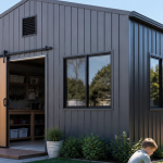
Satellite Reconnaissance: 5 Unexpected Ways to Use Satellite Images for Your Shed Project

When we hear about orbital surveillance, we usually picture defense agencies or climate scientists mapping melting ice caps. But for the everyday Aussie property owner, this exact technology is now a pocket-sized secret weapon for one of our most fundamental pursuits: planning, placing, and building a shed.
Consider the sheer scale of modern data: commercial satellites currently photograph over 300 million square kilometers of the Earth’s landmass every single day, driving a global geospatial market that topped $7 billion in 2026. This means the days of paying a premium for preliminary land surveys just to figure out your site’s basic topography are over. Whether you are plotting a massive commercial farm shed or positioning a simple backyard workshop to catch the winter sun, you can download hi res satellite images to completely remove the guesswork.
Unearthing Your Site’s History Before Breaking Ground
Before pouring a concrete slab for that perfect ShedBlog design, understanding your land’s historical and environmental behavior is crucial. By reviewing historical high-resolution satellite data, you can skip the expensive guesswork and safeguard your investment in three distinct ways:
- Tracking Historical Water Movement: The timeline feature in mapping tools acts as a digital time machine, allowing you to trace previous flood lines and seasonal erosion patterns. This guarantees your foundations are poured on genuinely stable, dry ground.
- Track Seasonal Shadows: By using historical satellite maps to track how those shadows shift across your block year-round, you can position your new shed to dodge the gloom and perfectly angle your roof for maximum solar power.
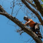
- Future-Proofing Against Vegetation: An orbital perspective reveals the mature canopy spread of nearby trees, helping you distance your slab from invasive root systems and hazardous overhanging branches.
Avoid Costly Boundary and Neighbour Disputes
Boundary arguments are a classic, expensive source of neighborhood tension. Before finalizing exactly where your new shed will sit, use satellite data as your unbiased, pre-construction advisor. It helps you navigate local council rules and keep the peace next door.
Buying a block with an older shed? Historical mapping tools are vital for you. You can click back through time to see exactly when that structure was built. In Australia, existing buildings are generally “grandfathered.” This means if a shed was lawfully built under the National Construction Code (NCC) in force at the time of construction, it is considered compliant, even if the code has since changed. You do not need to upgrade an old shed every time the BCA is updated; older structures are legally allowed to remain exactly as they are.
By using historical images to prove a shed has stood there peacefully for decades, you solidify its pre-existing status. Just remember, this protection applies only to the existing structure, not to any new extensions or works you plan to add. Conversely, if the images show the shed suddenly appeared last year without permits, you instantly spot a massive legal red flag.
Master Your Property’s Water Flow and Drainage
Let’s be real, getting your drainage wrong is the quickest way to wreck a perfectly good concrete slab. Before you even think about booking the concrete truck for your new shed, you need to know exactly what happens to your block when a massive Queensland downpour or a solid week of Victorian winter rain hits. Stomping around your yard in gumboots only tells you half the story.
To really see how the water behaves, you need a bird’s-eye view. Instead of guessing, you can look at high-resolution multispectral satellite imagery to spot the hidden damp zones and natural runoff paths that are practically invisible from ground level. You’ll clearly see exactly where the water pools, where the hidden creeks form, and which patches of dirt stay soggy for days after the rain stops.
Realistic Assessment of Bushfire and Flood Risks
Living in Australia means building with a healthy respect for the elements. Local council zoning maps are a good starting point, but an orbital reality check is absolutely essential for long-term survival and compliance.
- Bushfire Attack Level (BAL) Assessment: Satellite images let you measure the distance from your shed to nearby woods or scrub. This helps you estimate your Bushfire Attack Level (BAL) rating and choose the right fire-resistant materials.
- Flood Zone Visualisation: Look at past satellite images from wet and dry seasons to see how high floodwaters actually get. This shows you if you need to build your shed’s floor higher to keep it dry.
Keep an Eye on Rural and Investment Properties from Afar
Keeping track of distant properties is a massive hassle, but satellite mapping now acts as your long-distance set of eyes. Instead of driving for hours just to make sure everything is okay, you can do a quick digital drive-by right from your couch.
By checking recently updated or live high-resolution satellite images, you can see exactly how your property held up after bad weather. You will easily spot if a wild storm has ripped roof sheets off your shed or if a fallen tree is blocking your main gate.
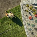
How to Get Started with Satellite Reconnaissance
So, how do you actually get your hands on this intel without needing a tech degree? Platforms like LandViewer are surprisingly user-friendly for the everyday shed builder. All you have to do is draw a quick digital box around your property lines, known as an Area of Interest (AOI), and the system lets you flick through years of visual history captured by high-resolution satellites.
Whether you’re trying to dodge a nasty boundary dispute with the neighbors, tracking drainage, or just making sure your new slab isn’t sitting in the winter shade, a quick digital check first saves a ton of headaches later. It guarantees your next Aussie shed is perfectly placed, council-compliant, and built exactly where it belongs.


